Saturday, November 4, 2017

Agawa Canyon Sept. 29 to Oct. 3, 2017

Yes it was that time of year for my annual pilgrimage down the Agawa, but this year was the first in many where I thought I would not be able to make the trip.

And of course this is a long winded, pic heavy story! 😃
So long and winded I am going to have to break it up into parts.  😇

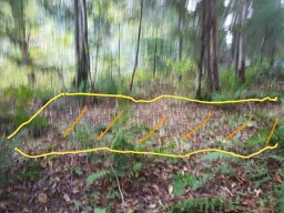
Here is a little bit of insight what it do to prep for a trip.
Do to a fairly severe ankle sprain I was hardly walking in July at all, I could not even carry my canoe to put in the bed of my truck.
By the first of August I was able to start to paddle again because where I paddle at Mountsberg Conservation Area has a boat ramp where I could pull right up to the water and that felt great!
It is also a great area to work on your bird photography from the canoe and that kind of practice comes in very handy.  It is a skill like your various other bush craft skills needs to be worked on so when you do get a chance you are somewhat ready and having a big lens is very helpful and shooting with it when it is off the tripod or uni-pod can make things very interesting, both from not getting blurry shots to balance in the canoe.

Here I saw the Blue Heron and got into a position where the wind would carry me in closer.  The less motion on your part the better.


Also training your eyes to spot the critters is important.  Blue Heron in the trees about 50m from the edge of the lake.


And being ready for surprises,  a Blue heron having a catfish lunch.


With bike riding, lots of therapy stretching and yoga stretches it was getting stronger but still very weak. As it strengthened over the two month prep period I slowly parked further away so see how I would handle carrying my 45 lbs. solo boat and worked my way up to about 150 metres with no real issues.  Paddle wise I got back up to doing my 10 km. loop in just over 1.5 hours (double blade), unless of course I stopped for bird practice.

Bike riding was great as I got up to over a 30 minute hard ride (at least for me) along the trail system they now have in Milton which also gave me some more bird practice at he storm water retention ponds.  I am very impressed with how bird populations have come to hang around these areas.

Common Tern


And Sometimes you get lucky with who is visiting.  Great Egret


What was really weird with this injury was I could ice skate and it would not bother the injury, which was great as I could exercise a lot of leg muscles  that were not being worked by my slow paced, deliberate walking style.

Walking was still an issue and was a lot slower in the recovery, but I got up to 4 km on city streets and did one 4 km test hike  on one of the easier trails at Rattlesnake Point with a 15 lbs pack.  
The test went well, except for the fact I could feel the weakness in the one spot in my foot and that was concerning since I knew I would have to be carrying heavier packs and a canoe on the portages.
Since this was a solo trip and I was not able to round up a young Sherpa I had to think this through a little bit.
For one it is shoulder season in Northern Ontario, temperatures and conditions change very quickly, and in the deepest part of the Canyon it is it's own micro climate so you have to have the appropriate gear for what you may encounter.  I took clothes and rain gear so that I would be more than reasonably comfortable if the temperatures got below 0c  and I would be okay at -10c or if I had a good and wet either by rains or an unexpected swim, being solo you need to cover the bases as much as you can.

At this time of year I usually take half my winter down bag, which is big, bulky but ohhhhh so warm, but this year I opted for a smaller, lighter summer bag a a very nice compact-able down blanket which worked out perfect for saving space and still be comfy at night.

I like to eat well, and I am not really fond a a week long diet of dehydrated foods so the only way to lighten up there is t make sure my portions are much more reasonable than I usually take, and with the farmers market in Milton I was able to acquire small vegetable sizes so I would not have waste.

With my camera gear I opted to be a little more frugal with what I brought along, the biggest bulk saver was not bringing my camera pack pack, it just meant packing all the odds and ends that I may use in separate zip lock bag so I "might" be able to find things when I needed them.

In the end I opted for more bags and barrels so I could spread the weight around and that would mean 5 carries on every portage and the only loose gear was paddles, ax and the 2 safety ropes and pin kit.
And that worked out well since I knew I would be going at a very slow deliberate pace on the carries.
(2-120L dry bags but not close to full, 1-60L barrel and 1-40L barrel for camera gear; plus canoe)

I had several goals for the trip and planned for 7 days, weather conditions permitting with lots of rest time for my ankle and photography.
I opted to use my 15.9 Discovery canoe because the the river gauges in the area said it should be close to what my son and I did in 2015 and the Discovery is a great boat in low level conditions, but it also my heaviest boat at around 70 lbs.
The Agawa itself does not have a gauge so you have to base the levels on the Batchawana and Wawa Creek gauges, but local rains can make a big difference.  The river was actually not at a bad level not low but not nearly as high as last years runs, but both gauges showed that river  should have been  around the levels I ran it in 2015 with my son and it was because of the lower levels that I opted for the Eton to Agawa bay route.
It is a long drive (just under 3 hrs) in on the logging road and a haul was in progress so you have to be on your toes! If you had a car you would not make it,  besides typical rough rocky roads there were two flooded stretches by beaver dams with one over 50m long.  There was fresh truck tracks going through so it made scouting these stretches much easier. 
It was such a bonus having a sunny very warm day with very little wind, it sure did not feel like October.

Anne's Traditional pic of me starting the trip just downstream of the Eton Logging road bridge.


When I got down to the falls at Eleven Mile Creek I got started on one of my trips goals and that was taking images with my cell phone.  Since my cell phone can shoot in RAW I wanted to be able to make comparisons to my DLSR, both present conditions and with images I had taken in the past.


I hiked up the first falls and found a little too much water to hike up higher without getting really wet.


I find myself a little to self conscious when doing selfies.


I got to the start of the narrows of the Canyon and began to portage the 800m down to my first campsite.  The Rapid has been known by several names, the early ACR called it the Goudge Gateway, after one of the early executives (the name really fits) The loggers knew it as "Princes Rapids" short for Prince of Wales Rapids, I have talked with the Missinaibi Cree First Nations Group that is trying to re-start the ACR passenger service about any original names they have for the area and that is something they are looking into.
I look so forward for the train, because it makes it so much easier to access this area.


When I got to the path to the camp site it was great to see the flagging tape on both sides of the trail down to it, even better was to see the big pile of dry firewood I left from last year, which meant I would not have to gather any wood for the first night and give me a chance to rest my foot.

First night, corn on the cob, baked potato and Rib Eye Steak.  When you camp here your are camping with a lot of those who stayed here before.


When you have it in your mind  that you are just going to trip in slow motion it really takes the edge off  where you need to get "stuff" done and having a hot summer day in October makes it that much easier.  When I went down to the river after dinner, after the shadows filled the canyon it was amazing  to feel the heat radiating off the the boulders that were not in the river.  As I pumped to fill my water bottles it was like sitting in a heated chair.  
Even though we were going into a full moon this week the orbit of the moon further to the south would mean the canyon would not that really special look when the moon is overhead.  It is still very bright but photography wise just not as good.

It was a pretty cool night, but because the ground was so warm it was a warm sleep and with very little wind a temperature inversion layer formed and it kept out the cold air so you had a layer of fog filling only about 3/4 of the canyon.  Once the sun started to rise, a gentle breeze kicked in and made for a mixing of the air.
Today was going to be a play with the camera day so I set off to a Lawren Harris location to do some time lapse movies.  Along the way the for made for some good photo practice.


So I set up for the time lapse and played with my other cameras while waiting for the magic of the sun and shadows to do their work.  This year I brought my tablet along, not only to bring copies of G7 paintings with me but it also takes a pretty good movie and the sound recording is really good.


While waiting for the times lapse I got to play with the tablet and I filmed some of the mists of the river, and the mists really do give you a chance for great photographic opportunities.
https://youtu.be/56wz39fBqVk

I have some good fall shots of Group of Seven Member Lawren Harris's "On the Agawa"  To really enjoy this spot you first have to be here at the right time of year and some nice sunny weather because with the shadow you really get to feel you are there for when the painting was being done.
Time Lapse
https://www.youtube.com/watch?v=lWjmuRqAZOk

My Still shot.


Link to Painting
https://i.pinimg.com/originals/42/dc/1a/42dc1a54e2ea4800a151eb6749c5fad6.jpg
pic


One of the really neat things about the Canyon is that fog/mists can occur anytime during the year making for surreal landscapes and photographic opportunities.  The many deep side canyons and how the sun warms these areas up at different times helps cause these neat mystical views.  As pretty as the mists are it can be a pain in the butt with moisture collecting on the lenses.

From the tablet, while taking the time lapse.

https://www.youtube.com/watch?v=56wz39fBqVk

The neat thing about sitting around waiting for just the right photo conditions you get to watch the world and sometimes other thing pop up.
I had been asked earlier this year if I knew this spot Lawren Harris - Algoma Sketch CXLVI 10.75 x 13.875 Oil on board (1920)
https://i.pinimg.com/236x/db/dd/f6/dbddf602833427c039ffdd93f3605aef--auction-sketches.jpg

Instead of having lots of paper copies of paintings it was easy to go to the folder on my tablet for reference and in this case it looked very familiar and being able to put painting on a photo was a great bonus.
I showed Jim Waddington the images when I got back and he agreed it was a pretty good match.  By the time I got up higher to take a pic I was shooting into the sun, and the lack of colours on the hill just means another reason for a trip in the fall!  😁

With the Painting inserted.

After the shadows finished with their show I walk south to another Lawren Harris, George Agnew Reid and an unknown photographer spot, sadly not a lot of wildlife sounds just a few northern Boreal forest birds, but it is all eye candy,


On the way back to camp I scouted the 2nd. rapid down from the campsite like I always do.  This rapid has changed a lot over the years with new features from year to year because some of the quarried rock can dislodge from the river right side.  I did notice a new feature river left near the bottom of the rapid, it "looked" like just a "clean" wave hole running from the river left shore out to about 3m.  but it looked like a clean run.  More to follow on this feature.

So back to camp to have another coffee (no instant "stuff" for this guy 😜) and enjoy this great spot.


I already knew of of several painting locations but had been unable  to find signs of the campsite.
Location of one of Surveyors Sidney Johnson's paintings from around 1901. And just so you know the one section just left of centre of the painting was dynamited away for a power line in the 1950's that was removed in the early 2000's and it was the removal of those power lines and the regrowth that brought back to life many of the G7 paintings that were done in the Canyon.


I did notice signs of a recent rock fall at the narrowest part of the gorge from the top of the canyon wall.  It is something you have to respect and be very aware of anywhere in the Canyon, it is constantly changing and this rock fall had happened between last years trip and this years.


One of major goals of this trip was to try and find evidence of the camp site that  had been used by the surveyors when they put the ACR tracks through and just the story of what I was looking for here was worthy of it's own post and how I found it was quite humorous.


The Shadows reveal a secret.


http://agawagroupofseven.blogspot.ca/2017/10/the-shadows-reveal-secret.html

See you at Part II 

Saturday, October 14, 2017

The shadows reveal a secret!

This posting was a long time in the making and it started over 100 years ago.
It is dedicated  to Sidney Wilkens, Grandson of Sidney Johnson one of the surveyors who worked on putting the railway through Agawa Canyon.

I met Sid a number of years  ago after I had just finished my fall trip down the Agawa when he and his wife Barb gave me a ride up to Frater Station where my vehicle was parked.

It is during this short ride we became friends and I learned of his Grandfather and how Sidney had come to the Canyon in the 30's with him.

At the time I was unable to identify where Sid had stayed.  Part of the problem was when looking for a waterfall as an identifier in the Canyon, where do you start, there are literary hundreds in a small geographic area, many of which are un-named.

Another problem was the forest had changed, where back in the day the vistas in the Canyon were clear, now much of the forest has re-grown and matured changing the look.  There is then whether it was a wet or dry season, the falls can look very different.

This mystery remained for a few years, even the journals as interesting as they were of Sidney Johnson and other surveyors that are stored at the Sault Ste. Marie Library gave no real clues since they are basicly work related notes.  I imagine to a surveyor historian they would be absolutley fasinating and they would be able to gleam a lot more information out of them than me.

Enter at this point another friendship developed from my love of the Canyon.  This one with Sue & and Jim Waddington authors of "In the Footsteps of the Group of Seven" whose life long passion of locating Group of Seven painting locations brought us together.

The Waddington's shared with me a Group of Seven painting from from a private collection, from the period of their Box Car trips to the Canyon, it sort of matched some of the waterfalls I had seen but could not place the location.  But once showing Sid, he new exactly which falls it was and I confirmed it the location in the summer that year, but the photo conditions were very poor.

Last fall the photo conditions were fantastic! so when I finished my annual trip down the Agawa my wife and I went up to get better images of this falls, and even this side trip was happenstance, only because our truck broke down and we had some extra days to do some extra exploring did we get this chance.

One of the things I have learned over the years coming up here, under the right conditions secrets and history will be revealed to you and sometimes you just have to be lucky.

I was familiar with the old station north of Frater not only because of the historical logging records but some of the old buildings that use to be there when I first started going up to the Canyon.  We were walking the trail in at the top of the old station, we noticed something that did look natural.


What it was was the log foundation outline of a structure they used for their canvas Bakers tents.  Both the loggers, the surveyors and construction crews would use these for their accommodations.
The yellow lines are the outlines of the logs, the orange hash marks are the inside  of the shelter and is un-naturally flat for the area.

I have seen images of these shelters before but had never found/seen them for real before.  This is an  exposed log of one.


The construction of these shelters was very similar to this link.

https://i.pinimg.com/originals/64/6c/db/646cdb709a37e0262afd923a0d3a271b.jpg

Which brings us to this year.  One of the goals this trip was to see if I could find any evidence that Sidney Johnson and the surveyor crews camped here.

Lets look at the timeline here, we know Sidney Johnson was here in 1901 by the date on his sketches and paintings, we also have his surveying journals (at the Sault Library)
In 1901 the tracks were not yet in this part of the canyon.
I know from talking to Sidney Wilkens and his story that his Grandfather almost starving in here and was forced to eat used coffee grounds as they retreated camp to camp to try and get out alive.
After spending a few weeks winter camping in the canyon I can tell you just how tough it is to get around in here, the weather can be absolutely brutal and as for hunting or wildlife, there is not a lot in here during the winter.
Even though they did meet up with their First Nations supply person and they were very upset at the late supplies, sometimes it was just too dangerous to move with the gear they had at the time.
This is not an easy area to travel through at the best of times.

Let us also look at the work ethics and environment of the time.  For one the boss is not going to let you walk a few hours to get to the next sections you are going to survey.  Your "office" is going to be close so you get the most work done in the shortest period of time.  In the canyon there are few good campsites.  This site is really the only reasonable site between what we now know as Canyon Station and Eton.

Besides the really long hours we know that they worked at this time period, Sidney Johnson would not have the time to capture in paintings and sketches the beauty of the area in what little free time he would have had.

So his camp had to be very close to his drawings.

Which brings us to this year.  As mentioned above lighting, plant growth and other conditions can make for finding and seeing things "different." I have seen various old cans, parts of rusted tools and metal since 85, I knew it was a very old established campsite, but nothing that was a solid lead to who actually camped here.  If you don't know what to look for it can be tough.
We know the Group of Seven was here on their Box car trips as there are numerous painting sites in the area, but they had their Box car at Canyon Station, but they could have had a shore lunch here.
We know that through early post cards  (1920's) that photographers were there (I have 2 in perfect condition)
We know George Agnew Reid (another famous painter) was here in the 30's so it is possible that Sidney Wilkens met him when he was here in the 30's

Did you met him Sid???? Yeah I know tough question it has been a few years since the 30's!
https://i.pinimg.com/736x/37/45/4f/37454f8b683ecae0238df51ac38aa85c--self-portraits.jpg

Which brings us to this years special moment, and yes it really is humorous on how the secrets of the canyon are "Exposed"  😊

In this 2014 pic, I brought in a "Thunder box " to help keep the campsite contained and clean.
Please note the plant growth in front of the box.


September 2017, over 100 years since Sidney Johnson painted and worked here.
I am "sitting" here contemplating life, 😎 the light is flat, the plant growth has died off at bit and I see this.  I say HOLY "STUFF"! 😇  All these year the evidence was right there proving if you don't know what you are looking for, you are not going to find it.  I can not explain the reason the background is overly foggy and blurred, (I was sitting very still)  but I am going with the spirits of those who passed here before.


The yellow line is the log rectangle that would be the outer frame.
The orange is the flat, living area (and is unusually flat for this area)


Wall sides


Which brings just how close we are to the Water colour painting site.


A- is the camp site.
B- is where Sidney Johnson would have painted from.


The water colour painting site October 2017


I really had to smile after this, so many things had to come together to actually be able to see this.
I knew I was far from the first to visit this area, but I am really happy that the Canyon continues to shows me it's secrets.
Could it have been a loggers camp? I am sure they had shore lunches here to. But logging was done through here well after this and the logs frame had turned back to the forest much more than the one just north of Frater except for the "bumps) in the ground.

I am just another traveller through the area who has found a special place, and it is special!

Thank you Sidney Wilkens for sharing some of your storey, and for inspiring me to follow these shadows.

The campsite that I have used for years, just metres away from the other site.


Friday, September 22, 2017

Well I thought I would share this again so you can have a little glimpse of history.
I am just getting ready for my annual fall pilgrimage to the Canyon.
Just so the rest of you know the Black and White sketch is on the opposite side the hill of the water colour.

I plan on doing something a little different and do a couple of movies, one will be at the campsite that Sidney Johnson most likely used when he drew this pictures.
And we will talk about a "few other" spirits who have visited the area. :)
And yes it will be a full moon again :)

http://www.myccr.com/phpBB3_PROD/viewtopic.php?f=90&t=43631&p=400738#p400738


Monday, June 6, 2016

Do North

Just a little slide show I put together for a contest in the Soo Today.
Probably a little long for their desires but Algoma is eye candy
So grab a beverage sit back and enjoy!

https://picasaweb.google.com/114224116055024928868/6290841450810373345?authuser=0&feat=directlink

Friday, October 16, 2015

Agawa Canyon Canoe Trip Sept. 26 to Oct 2, 2015

Agawa Canyon Canoe Trip Sept. 26 to Oct. 2, 2015

Trip report of PJ McColl's and my fall trip to the Agawa is now up for your enjoyment.
And it is long and Pic heavy.

Yeah this is sort of cheating but it is as long as the river was low.
So this is just way easier than fixing all the links and pics to work here.


http://www.myccr.com/phpbbforum/viewtopic.php?f=108&t=44451

Jeff

Monday, August 17, 2015

The bucket list paddle.


The bucket list, most know the movie, and most people have such a list of things to do or places to go.

I have been paddling for almost 50 years now and have done and seen some amazing things on the water.  I have won National titles in both whitewater and sprint canoeing.  I have trained, competed against, paddled with and have been friends with the best in the world both racing and recreational paddlers.

I have paddled many great rivers and waters around the world.  I have paddled some great first descents and rapids that are on many peoples list such as the Skookumchuck  Narrows in BC. And have paddled among huge icebergs in Newfoundland/Labrador.

There are many places I would like to go, but there is one that has been on the “list” for a long time and this will shock a lot of people that know “paddling” me.

We take you back to 1976, fastest in the Country in Downriver racing and most of my paddling is leaning to the “big” side of the scale.
We were traveling to the Nationals in Alberta when just to the west of Marathon Ontario, Highway 17, the Trans Canada makes a fairly sharp turn to the west around a small Boreal lake, nestled into a beautiful mountain setting.  The threatening clouds and darkening skies added to the depth and beauty of this lake.
 
Right then and there, I said I had to paddle this lake!
I have been to Northern Ontario many times since then but had not been able to stop and paddle here for a variety of reasons.
So this year I knew we where going up to Northern Ontario for two weeks at the end of July so the plan was to definitely go and paddle this pretty little Boreal lake named “Wolf Camp Lake” on the maps.
Not much has changed on this lake from when I first saw it except there is now a microwave tower on top of the big hill at the north end.  There is a little dirt road that follows the east shore but you don’t really see it from the lake.

Access is really easy as there is a turn off and parking area right beside the lake when you get off the highway and there is little sign that it gets used very much and there are no camps or cottages on the lake.

So for 39 years this lake has been in the back of my mind, that I should paddle it, why? I don’t know, but I will Share with you what I found.

Once we were ready to paddle and the boat was off and on the edge of the lake we gave a gift of tobacco to Mother Earth and the Lake. 


My paddling roots run very deep in Northern Ontario, my Father worked on the Algoma Central railway after WWII and was partnered with a First Nations member who taught him paddle and bush skills, which has led to my life long love affair with paddling, so this gesture was more than appropriate.

As we move through the reeds to open water an Eagle circled overhead and cried out….  Very cool indeed.


My wife Anne joined me for this pilgrimage, since I have been talking about this lake since we took the kids up for the Sault – Thunderbay loop 20 years ago.


We paddled along the east shore heading north, there was a small little island and the shoreline rises gently for a short distance then raised very steeply helping give that lake in the mountains effect.


There was a nice wind blowing, not too strong, but enough to keep the bugs at bay as we slowly made our way along the shore.  When we got to the north shore there was a tiny lagoon with a small stream flowing in and we were given this terrific view looking towards Hwy. 17


This end of the lake was definitely the “high end” beach strip.


This end of the lake has a little turn in it and you only hear the sounds of the wind as we paddled in some more reeds.


As you paddle south, along the west shore, the cliffs rise right out of the lake.


It is beautifully rugged and it feels you are being watched from the hills.


Looking at the eastern hills and shore.


Another small stream enters the lake towards the south end.


Looking north from the southwest shore.


I hope you enjoyed paddling around this pretty little lake with us.

So what did I find?
A beautiful peaceful place to paddle on one of Northern Ontario’s Boreal lakes.
What did I expect to happen?
That I don’t know, in the beginning there was just whisper in the back of my head that I should paddle there, but there where no visions or secret messages.
There was though a great sense of peace and relaxation, but that I have felt whenever I paddle and camp. 
So maybe that is the message to share what I have found so others and also find these wonderful places.
Wolf Camp Lake, if you go here or any other special place to you, make sure you leave it for others as you found it.

Jeff McColl

Link to my Northern Album 2015.